Project Summary
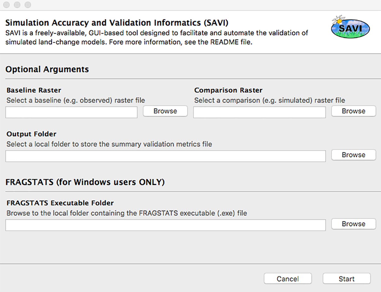
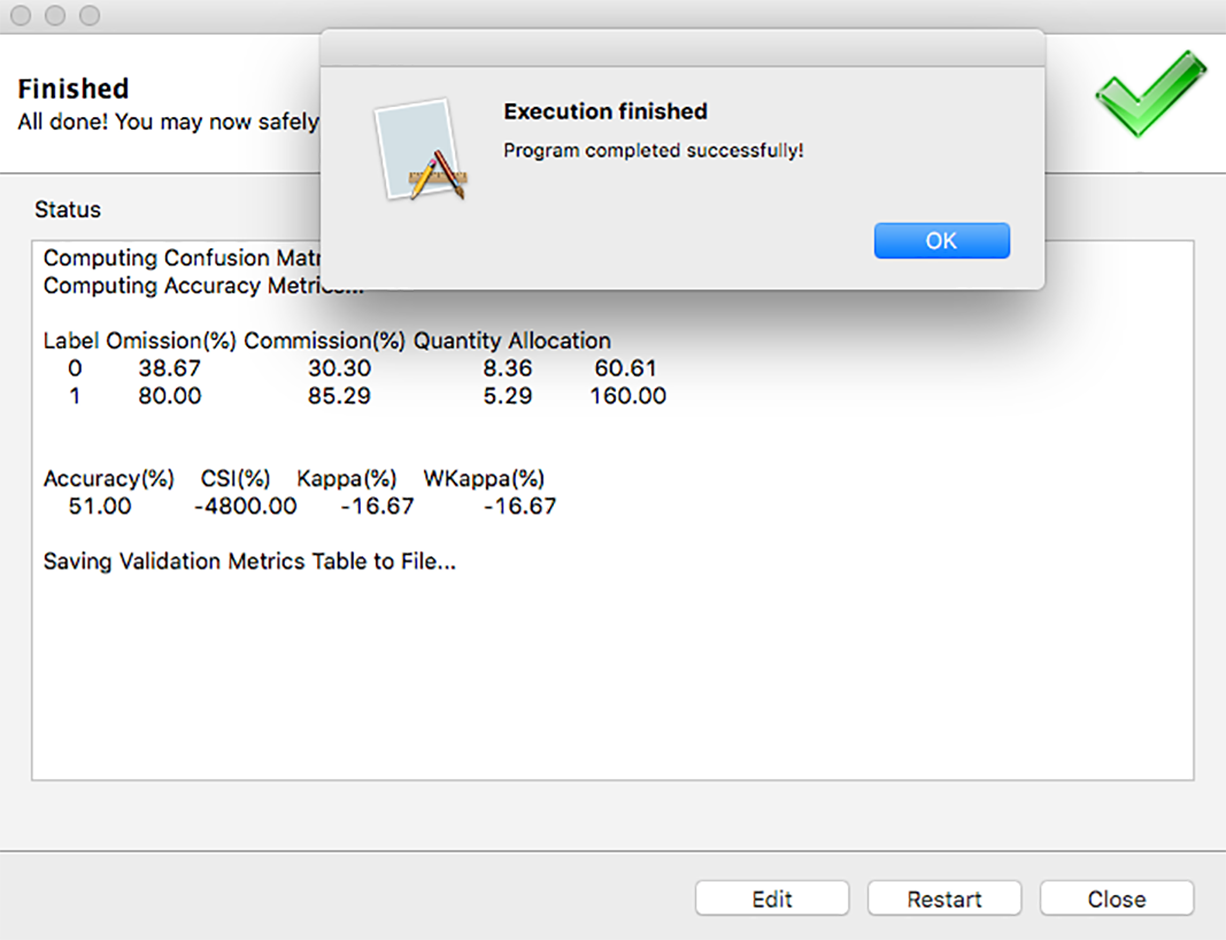
The Simulation Accuracy & Validation Informatics (SAVI) tool is a convenient, freely-available GUI-based tool designed to facilitate and automate the validation of simulated land change models. This tool was developed to address the growing lack of validation assessments conducted following use of land change models to project land cover to future time periods. This tool can be used with any raster and provides multiple accuracy and validation metrics that are well vetted within published literature. Ultimately the choice of which accuracy and validation metric to use is at the discretion of the researcher. The current version of SAVI is made of two main sub-modules: a classification accuracy metrics module and a configuration metrics module (relying, at the moment, on the FRAGSTATS software).
Objectives
- Facilitate and automate the validation of simulated land change models
- Develop a cross-platform, freely-available, GUI-based tool
- Address the growing lack of validation assessments conducted following use of land change models to project land cover to future time periods
Technology
Project Website:
https://github.com/f-tonini/SAVI-tool
Deployment Architecture:
Windows/Linux/Mac OS, GDAL, pynsist
Language:
Python