Project Summary
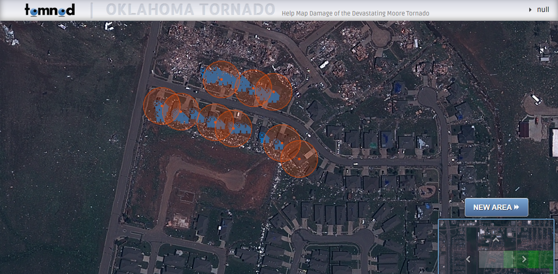
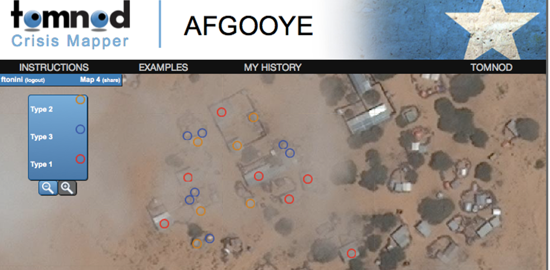
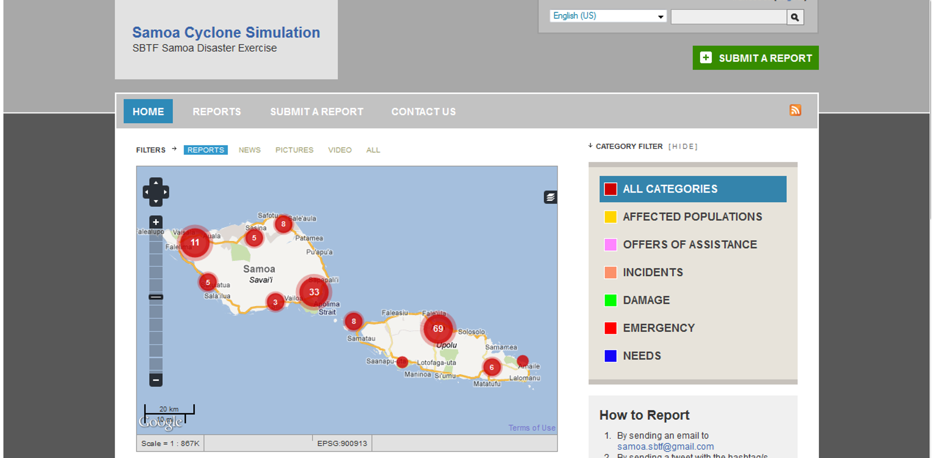
As a volunteer and mapster in the Standby Task Force (SBTF), I had the opportunity to work on several crowdsourced humanitarian relief projects. In 2011, SBTF mapsters analyzed more than 3,000 individual images and tagged more than 9,000 shelters in the “Afgooye corridor”, an area between Mogadishu and Afgooye that due to war and famine had become one of the largest urban areas in Somalia. The Standby Task Force group supported the United Nations High Commissioner for Refugees’s (UNHCR) efforts in Somalia in order to get a better sense of where IDP camps were located and provide better service delivery. Rule-sets and feature-keys for tagging IDP camps were refined prior to the deployment. Volunteers were asked to use the Tomnod platform and the satellite imagery provided in order to spot by human-eye solely and tag IDP shelters and buildings. For more information, read the full blog post. In December 2011, the Samoan Government and Samoa HEAL, with the support of the United Nations Platform for Space-based Information for Disaster Management and Emergency Response (UN-SPIDER) ran a simulation of early warning and emergency response to a cyclone. Different groups of volunteers were assigned to different tasks, such as: SMS-email, translation, reports, and geo-location of localities hit by the disaster using open source data portals on the web. For more information, check out the full blog post. On Monday May 20, 2013, a powerful tornado impacted the towns of Moore, Newcastle, and southern portions of Oklahoma City, causing widespread destruction. CrisisMappers launched a crowdsourced effort to analyze satellite imagery and mark damaged buildings in parts of the state of Oklahoma stricken by a F-5 tornado. The web application published by Google Crisis Response is no longer updated nor maintained. Screenshots are reported below.
Objectives
- Get a better sense of where IDP camps were located and provide better service delivery
- Tag IDP shelters and buildings from historical satellite imagery to estimate occupancy rates and calculate the total population
- Geo-location of localities hit by the disaster using open source data portals on the web
- Analyze DigitalGlobe’s cloud-free satellite imagery and mark damaged buildings in parts of the state of Oklahoma stricken by a F-5 tornado
Technology
Project Website:
https://bit.ly/2wQ0S0q
https://bit.ly/2oKUmod
https://bit.ly/2NoYAQi
Deployment Architecture:
Tomnod, Open Street Map, SBTF